Current development plan
The statutory Development Plan is the starting point in the consideration of planning applications for the development or use of land, unless material considerations indicate otherwise.
In Ashfield, the plans and policies that make up the Local Development Plan are:
- The Ashfield Local Plan Review 2002, saved policies which apply to the district
- The JUS-t Neighbourhood Plan whose policies cover most of the Parish of Selston
- The Teversal Stanton Hill and Skegby Neighbourhood Plan whose policies will apply to neighbourhood area identified in the Plan.
In addition, Nottinghamshire County Council are responsible for the minerals and waste development scheme:
Ashfield Local Plan Review - 2002 (Saved policies)
The Local Plan was adopted on 22 November 2002. Under current national planning policy (the National Planning Policy Framework) due weight can be given to relevant policies in the Ashfield Local Plan Review, according to their degree of consistency with the National Planning Policy Framework. The closer the policies in the Plan are to the policies in the Framework, the greater the weight that may be given.
The Ashfield Local Plan Review is divided into sections:
- Section 1: Introduction and Strategy (Chapters 1 and 2): This section outlines the need for the Local Plan and its strategic background. The strategy chapter indicates the aims of the Plan. It includes an overall policy relating to any development and sets out the strategic approach towards development in different parts of the district.
- Section 2: Land Use Policy and Implementation (Chapters 3-9): This section considers land needs for specific uses and identifies sites for development or protection.
It includes:
- Chapter 3: Environment
- Chapter 4: Employment
- Chapter 5: Housing
- Chapter 6: Transport
- Chapter 7: Shopping
- Chapter 8: Recreation
- Chapter 9: Implementation
However, not all policies are applicable. In 2007, the Secretary of State for Communities and Local Government issued a direction under paragraph 1(3) of Schedule 8 to the Planning and Compulsory Purchase Act 2004, that meant that any policies that duplicated national planning policy at the time no longer applied to planning decisions. The ‘saved policies’:
Continue to apply to the consideration of planning applications within the District, are as follows:
- Strategic policies : ST1, ST2, ST3 and ST4
- Environment policies : EV1, EV2, EV4, EV5, EV6, EV8, EV10, EV11, EV14
- Employment policies : EM1, EM2, EM4 and EM5
- Housing policies : HG1, HG3, HG4, HG5, HG6, HG7, HG8 and HG9
- Transport policies : TR1, TR2, TR3, TR4, TR5 and TR6
- Retail policies : SH1, SH2, SH4, SH5, SH7, SH8 and SH9
- Recreation policies : RC1, RC2, RC3, RC4, RC5, RC6, RC8 and RC9
Proposals maps
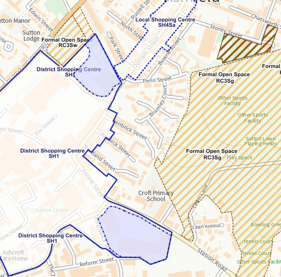
The Proposals Map identifies in detail the location of sites on a policy-by-policy basis.
The online map information is for guidance purposes only. The definitive proposals map should be referred to for more detailed information.
You can view the map online or find PDF versions of the map in the downloads section of this web page.
- The North Sheet covers Sutton in Ashfield and Kirkby in Ashfield
- the South Sheet covers Selston, Jacksdale, Underwood, Annesley, Woodhouse, and Hucknall
- link: Online proposals map
Neighbourhood plans
Neighbourhood planning is a way for communities to decide the future of where they live and work. Neighbourhood development plans set out a vision for the use of land in the community being prepared by parish councils or neighbourhood forums.
The neighbourhood plans form part of the development plan for the area in question along with the saved policies in the Ashfield Local Plan Review 2002. Therefore, where relevant to a planning application, they must be taken into account as part of the development plan policies.
Neighbourhood plans have been made for the following areas in the District of Ashfield.
The Parish of Selston (excluding a small area included in the Parish from 1 December 2016). There is more information on the JUS-t Neighbourhood Plan on:
The area comprising Stanton Hill, Skegby, Teversal and the rural area to the north of Sutton in Ashfield. There is more information on:
Contact details
- Forward planning
- Contact planning
- localplan@ashfield.gov.uk
- 01623 457382
-
Ashfield District Council
Council Offices
Urban Road
Kirkby in Ashfield
Nottinghamshire
NG17 8DA
Downloads
Some files may not be accessible to everyone. You can request the file in a different format from the contact on this page.
Page last updated 09 September 2025